Ted Rumble | Niagara Historical Society | October 2023
Photos courtesy of Cosmo Condina
Summary
The British Army maintained a military presence in the Town of Niagara until 1865, to guard against another American invasion from Fort Niagara. Between 1823 and 1854 the British Army Royal Engineers placed 37 Ordnance Boundary Stones around the perimeter of the four military reserves in the town of Niagara. Military reserve lands included Simcoe Park, Queen’s Royal Park, the Niagara-on-the-Lake Golf Course, and the Commons. Each stone was carved with the initials BO (Board of Ordnance) under the Broad Arrow symbol which identified military property of the British Government. Many of these stones can still be seen today.
The Town of Niagara-on-the-Lake has committed to a program of restoration and protection of the Ordnance Boundary Stones.
Contents
Introduction
At its very founding, Niagara-on-the-Lake was a British military town.
In May 1813 the American soldiers from Fort Niagara crossed the Niagara River in boats and captured the town and Fort George. In December 1813, the Americans burnt the town and retreated back across the Niagara River. The British Army re-occupied the town.
For the rest of the 1800’s, the British were concerned that the Americans may invade again. Some Americans believed it was their “Manifest Destiny” to occupy all of North America and drive the British out. Many prominent people were annexationists, who believed that the British colonies in North America must eventually be annexed to the United States, by force if necessary.
Consequently, the British Army maintained a strong presence in the town. They were determined to control the entire shoreline opposite Fort Niagara.
In the town of Niagara there were four parcels of land that were reserved for military use. The Ordnance Boundary Stones (OBS) were erected around the perimeter of these four military reserves 200 years ago. Some of these stones can still be seen today.
History of the Ordnance Boundary Stones
The earliest reference to the Ordnance Boundary Stones appears in a letter from Col. E.W. Durnford dated June 19, 1823.
Col. Elias Walker Durnford was the commanding officer of the Royal Engineers in Canada in from 1816 to 1831. He was stationed in Quebec.
This letter draws a direct connection between the 1823 ‘Crooks Swap’ and the installation of the Ordnance Boundary Stones.
There were originally 37 stones. As discussed below, it appears that OBS 1-32 were put in place in or soon after 1823. OBS 33-36 and OBS 5 1/2 were put in place around 1853.
Military Reserves
The Board of Ordnance owned four parcels of land in the town of Niagara. They are the Garrison Reserve, the Mississagua Reserve (sic), Lots 79,80,89,90, and Vacant Town Lot A.
|
Military Reserve |
Known Today as |
Ordnance Boundary Stone Numbers |
Original Number of Stones (Total 37) |
Stones Found Today (Total 19) |
|
Garrison Reserve |
The Commons |
1-19 |
20 (including |
1, 3, 4, 5, 10, 16, 17 |
|
Mississagua Reserve |
NOTL Golf Course, Queens Royal Park |
20-28 |
9 |
21, 22, 23, 25, 26, 27 |
|
Lots 79,80,89,90 |
Residential lots |
33-36 |
4 |
33, 34, 35, 36 |
|
Vacant Town Lot A |
Simcoe Park |
29-32 |
4 |
31, 32 |
Appearance
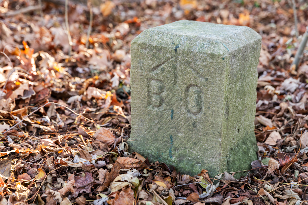
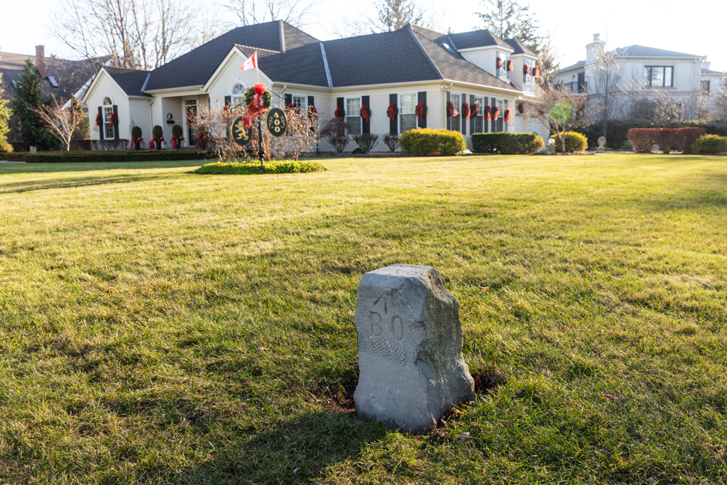
The stones appear to be matching. They are made of light gray Queenston limestone measuring 9 inches square, with beveling on the top edge. The front is engraved with the initials BO, beneath the Broad Arrow. An Arabic number is engraved on the back, corresponding to the map references (for the most part).
The BO stands for the Board of Ordnance, the custodian of military property for the British Government from 1671 to 1855.
The Broad Arrow was the symbol used by the Board to identify military property of the British government.
Below is a list of the four military reserves with the Ordnance Boundary Stones on each that have been found today.
Garrison Reserve
The Garrison Reserve corresponds closely to The Commons today.
It was originally laid out by Lt. Pilkington R.E. (Royal Engineers) in 1796.
It was originally bounded roughly by (today’s) John Street, King Street, and the Niagara River. In 1817 there were only military installations below King Street along with the English Church.
Over the years, several parcels of land below King Street on the Garrison Reserve were ceded. The biggest of these was the Crooks Swap in 1823, in which James Crooks gave up his land on the Mississagua Reserve in exchange for 7 lots on the Garrison Reserve. Four of these were in the block bounded by King, Picton, Wellington, and Castlereagh Streets. The other three were Lots 9, 17, and 18, adjacent to the entrance to Fort George, with water access (Bonnycastle, 1835).
OBS 1
OBS 1 is at the southern end of the Garrison Reserve, close to the river. It was found by the Larocque Group Surveyors in 2023. It was slightly below grade.
It is located 223 links from the shoreline[1], which is about 150 feet.
OBS 3
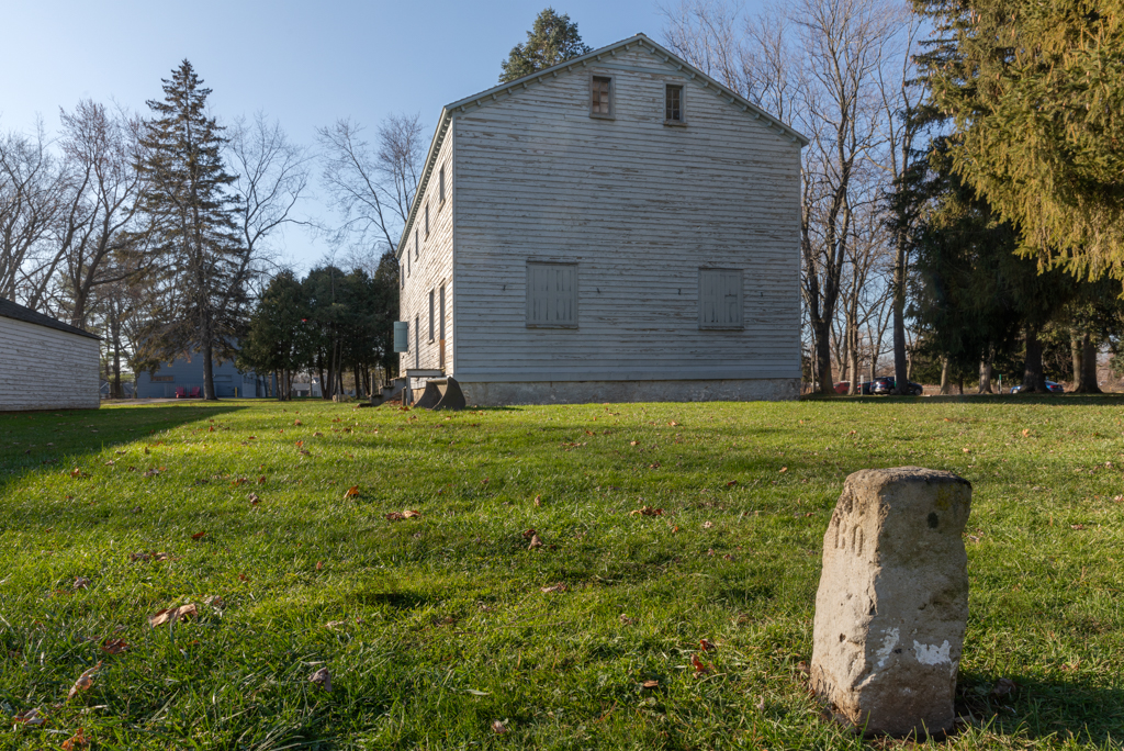
This stone can be seen today in the centre of Butler’s Barracks, which is not an Ordnance Boundary. Clearly it has been moved. This probably explains why it is set too high out of the ground.
OBS 4
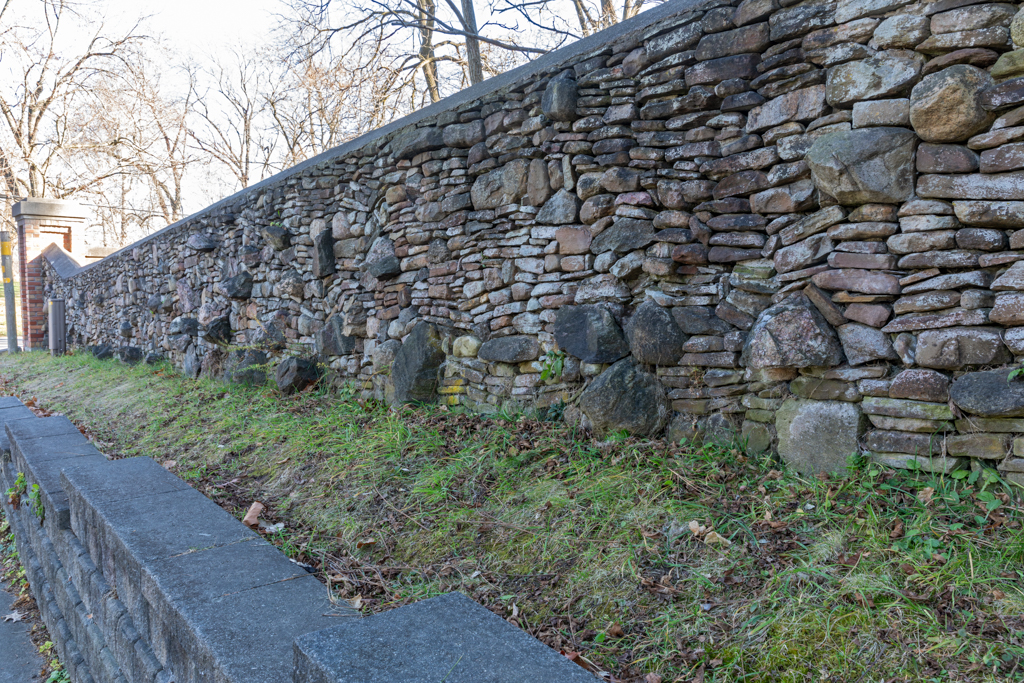
This stone is found today on Charlotte Street embedded in the stone wall of the Rand Estate which was built in 1908.
The fact that the wall extends beyond the stone indicates encroachment onto military land when it was built.
OBS 5
Originally the Garrison Reserve extended to the corner of King and John Streets. By 1853 the boundary was moved to allow the Erie and Ontario Railway track to curve around to what is now the Heritage Trail. This explains why this stone is no longer on King Street. The line was constructed in 1854. The E&O became the Michigan Central Railway (MCR).
The MCR came from the harbour, over the trestle bridge, down King Street, and then curved around at John Street, and continued along today’s Heritage Trail.
OBS 10
OBS 10, is at the corner of King and Byron Streets, which was probably not its original location.
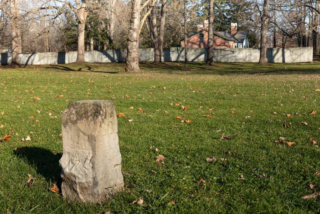
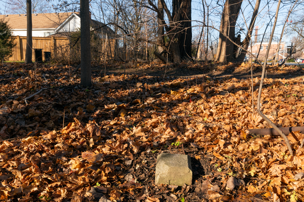
OBS 16
This stone was found near the entrance to Fort George.
It is near the base of a large tree, quite sunken and tilted.
It is on the corner of the property once owned by James Crooks.
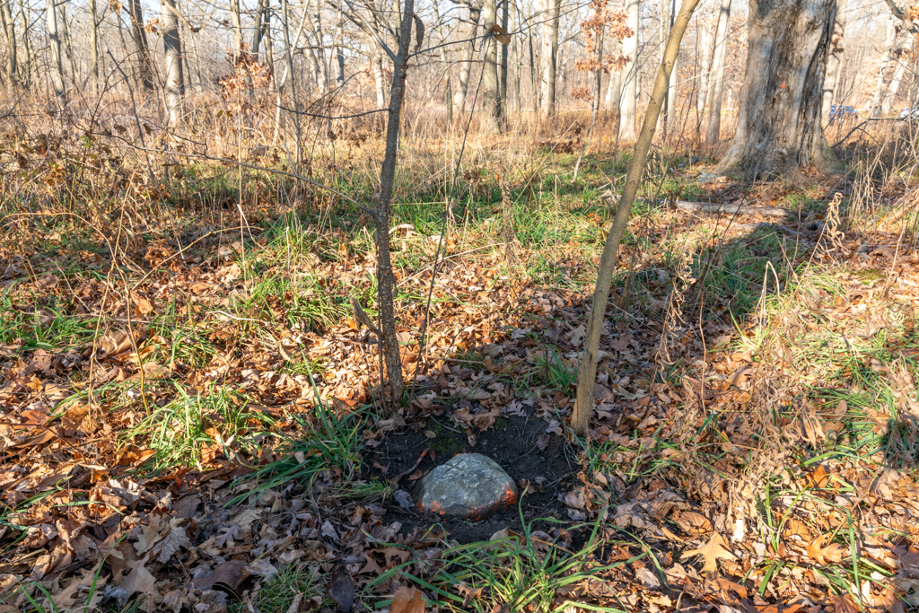
OBS 17
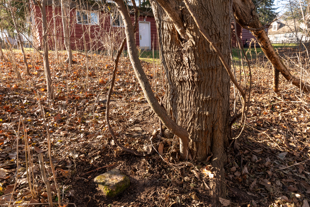
This stone was found in the thicket off Brock’s Bastion. It is very sunken down and covered in moss.
Mississagua Reserve
The Mississagua Reserve was demarcated by OBS 20-28. (Modern spelling is Mississauga.)
The Mississagua Reserve was probably named after Mississagua Point, the most prominent part of the shoreline at the mouth of the Niagara River. Originally this reserve was much smaller but was augmented by the 1823 Crooks swap, by which the British Army gained control of the entire shoreline facing Fort Niagara.
OBS 21
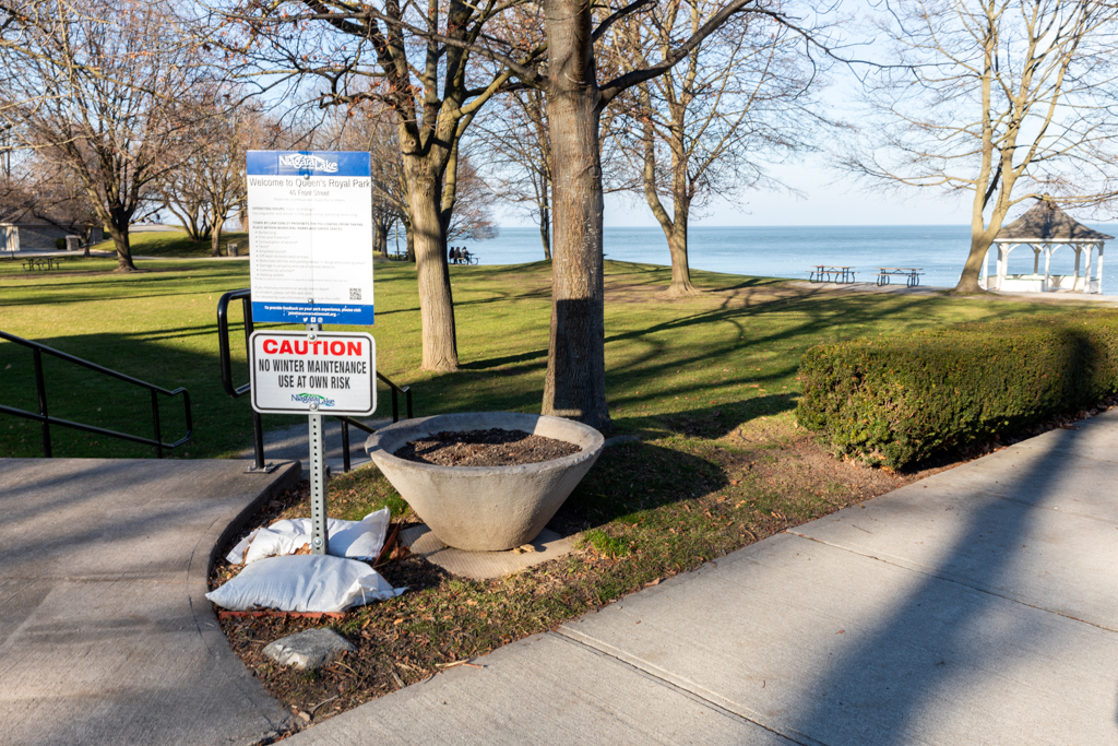
This stone is at the corner of King and Front Streets at the entrance to Queens Royal Park, just beside the steps. It is nearly flush with the ground.
Originally the Mississagua Reserve extended all the way to King Street and included the entire shoreline facing Fort Niagara.
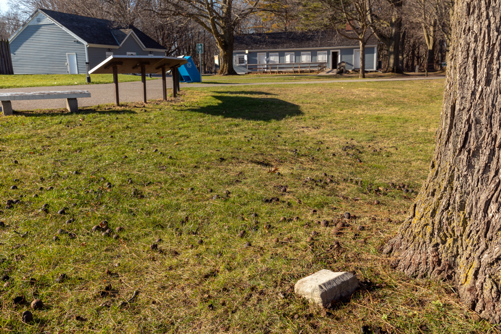
OBS 22
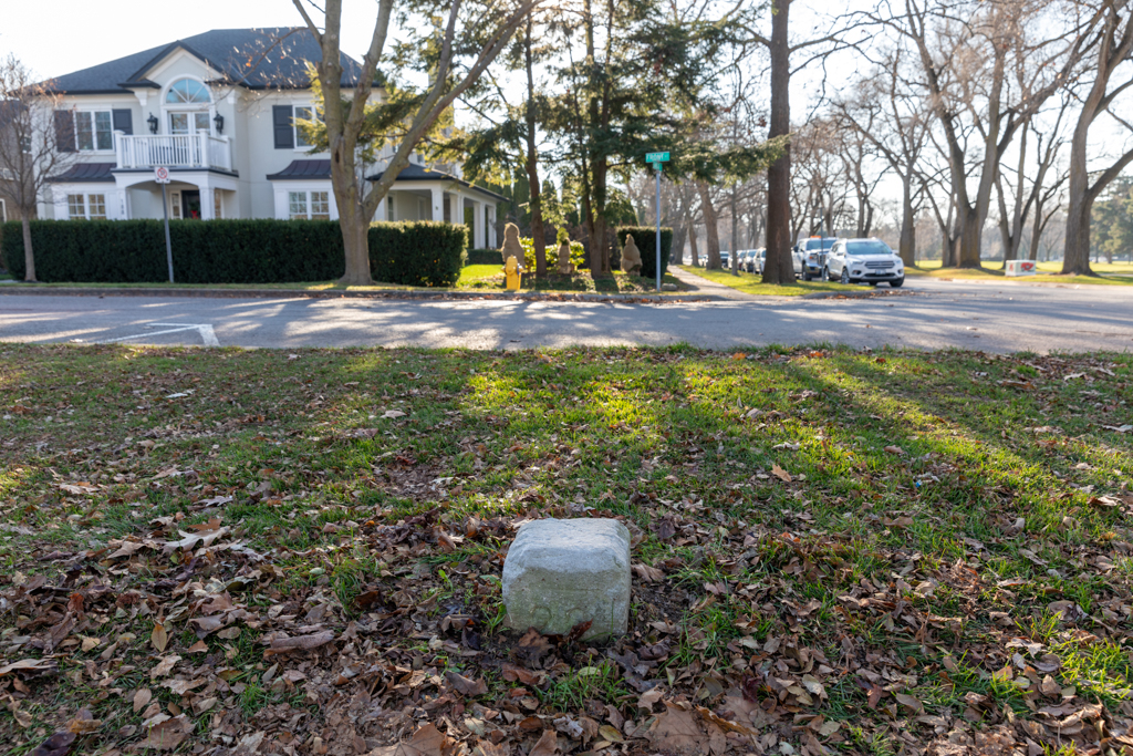
This stone is clearly visible at the corner of Front and Simcoe, beside the golf path. It is partially sunk into the ground.
OBS 23
This stone was clearly visible at the corner of Prideaux and Simcoe, opposite the golf course. It was broken at the base, probably from impact from a riding mower or snowplow; the top could be lifted off.
In the winter of 2020 OBS 23 was hit by a sidewalk snowplow; the top was knocked off and is now in the possession of the Niagara-on-the-Lake Museum.
Originally Simcoe Street stopped at Prideaux, where you must turn right, or you find yourself on the military reserve.
OBS 25
OBS 25, 26, and 27 mark the boundary between today’s Charles Inn property and the Mississagua military reserve. This parcel of land was once owned by James Crooks, but he sold it before 1823, which explains why it was not included in the Great Swap.
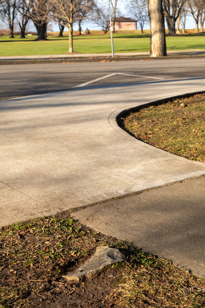
OBS 25 is found at the Charles Inn property line at Simcoe Street. It is about 6” below grade. It was discovered and marked by the J.D Barnes Surveyors.
OBS 26
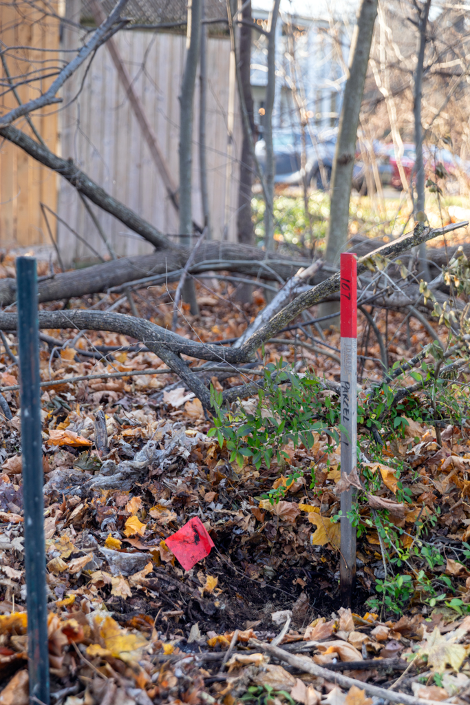
This stone is at the inner corner of the Charles Inn property, hidden in the bushes, close to the 9th tee of the golf course.
It is in very good shape, at the right height, showing the beveling and the engraving clearly.
OBS 27
This stone was originally on Queen Street at the west corner of the Charles Inn property. It is found today in front of the Junior Commissariat in Butler’s Barracks.
Vacant Town Lot A (Simcoe Park)
This parcel of land is located east of King and Picton Streets, beside the parcel allotted to the Roman Catholic Church.
Originally all land below King Street was military land. Over time land was ceded to the English Church, the Roman Catholic Church and to James Crooks, leaving Town Lot A as an island of military land.
On the 1853 map OBS 29-32 are the four stones on the corners of Vacant Town Lot A, which we know today as Simcoe Park.
The plot is nearly square (634 links X 630 links).
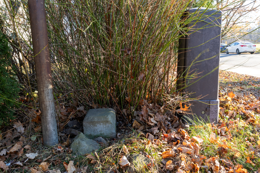
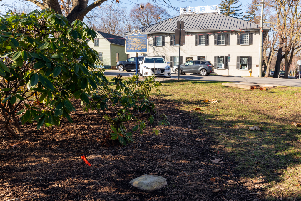
OBS 31
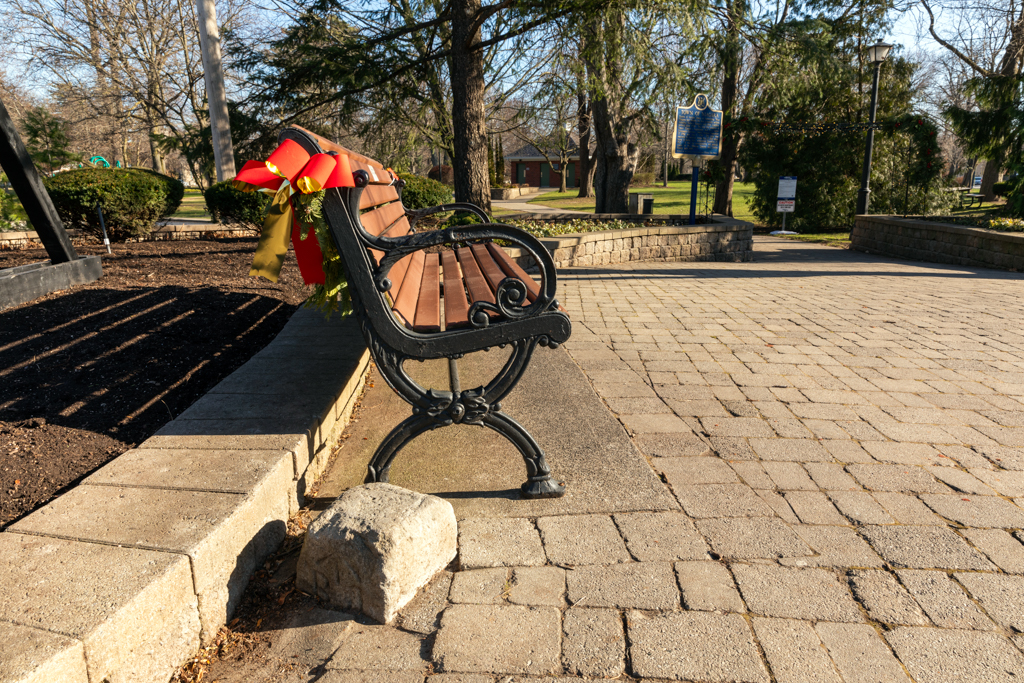
This stone is seen today at the entrance to Simcoe Park, at the corner of King and Picton Streets, across from the Prince of Wales Hotel. It is beside a bench, with paving stones all around. It has sunk a long way down, though the “BO” and Broad Arrow can still be seen.
OBS 32
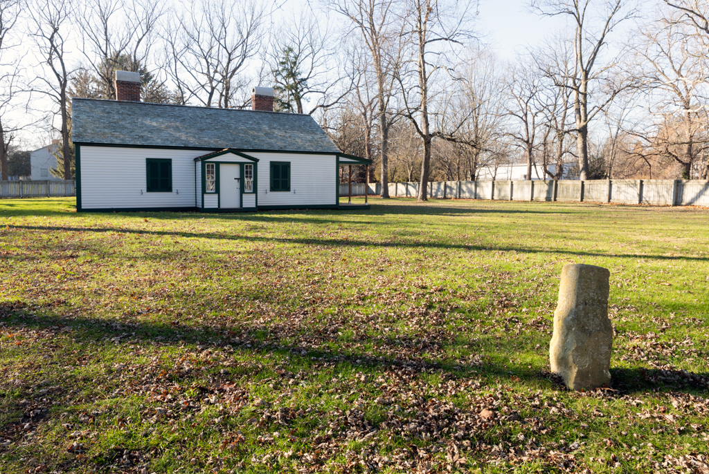
This stone is found today in the Simcoe Park garden at the corner of King and Byron Streets. It was completely buried but brushing away some mulch and dirt showed it in the right place. The Town is planning to restore and protect OBS 32 in the spring of 2024.
Lots 79, 80, 89, 90 (Hospital Block)
There is an undated map at the Niagara-on-the-Lake Museum that indicates that the town was planning to build a public hospital here, but around 1854 they swapped it for lots 103 & 104, and it became a military reserve.
There is a note on the 1853 map saying, “Lots 103 & 104 Conveyed to Corporation for Lots 79, 80 ,89, & 90 Bd’s order 4 March 1853.” Lots 103 & 104 are the southwestern half of the block bounded by King, Queen, Regent, and Johnson Streets (where the Irish Harp is today). This supports the idea that this military reserve was the last one added.
Stones 33-36 were on the four corners of the Hospital Block, which is bounded by Queen, Dorchester, Johnson and Nassau Streets.
OBS 33
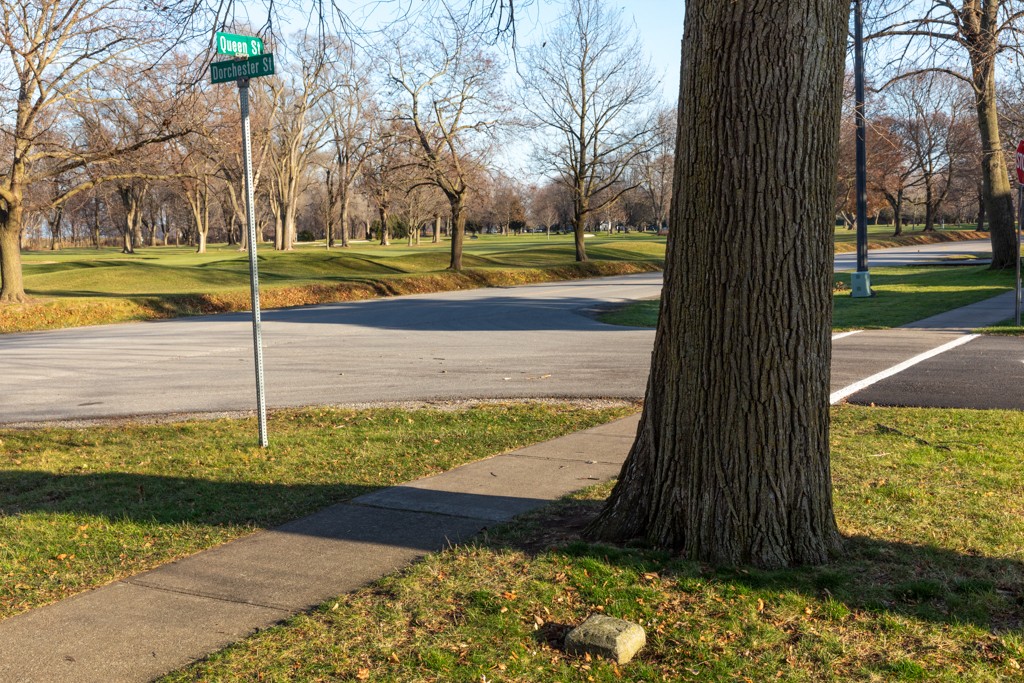
OBS 33 is at the corner of Queen and Dorchester.
OBS 34
This stone is at the corner of Dorchester and Johnson.
OBS 35
This stone is at the corner of Johnson and Nassau Streets. It was struck by construction equipment and damaged sometime between June 2019 and November 2019.
OBS 36
This stone is at the corner of Queen and Dorchester on the Hospital Block.
Conclusion:
The Ordnance Boundary Stones of Niagara on the Lake are an important historical artifact that takes us back to the very founding of our town.
Nineteen of the original 37 stones can still be seen today.
It is incumbent upon us to . . .
- Recognize the historic value of these stones
- Restore these stones by repairing those that are broken, and raising up the ones that are sunken.
- Protect them from further damage, and
- Celebrate them as having great historic interest to both residents and visitors for generations to come.
[1] A chain is 66 feet. One link is 1/100 of a chain and is equal to 7.92 inches.